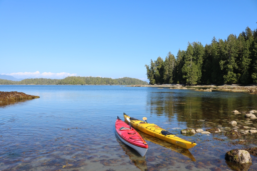
After a rainy but fun week in Tofino which consisted of surfing and then trying to warm up after surfing, we packed up the car and headed south to Port Renfrew. We had booked one night in a luxurious yurt/lodge in Port Renfrew so we could relax and dry out our camping gear before starting the West Coast Trail the next day. We stayed in the Tatoosh Yurt at the Soule Creek Lodge and enjoyed dinner at the lodge as well – I highly recommend it! The meals are gourmet and absolutely delicious.
We went to the required pre-hike trail info session that afternoon in order to be able to take the earliest water taxi to the trail head the next morning. The first thing they showed us was the forecast for the week – hot and sunny all week long! Such a relief after the constant cold drizzle in Tofino. After an hour, we were briefed and excited about the hike, now it was time to check in to the lodge and deal with all of our wet gear.
Day 1: Gordon River Trail head to Camper Creek – 13 km, 5.5h
We had requested an early breakfast in order to make it to the hike info centre where we would take the 8:45 water taxi to the trail head. The only parking is pay parking at the info centre ($5/day, cash only) which we weren’t aware of before arriving in Port Renfrew so this took a decent chunk of the cash we’d allotted for lunch at Chez Monique’s mid-hike. Now we only had $53 which we’d heard should be able to get us a burger each and maybe a drink to share. We later found out (after leaving our wallets in the car) that Chez Monique now accepts credit card payment as well (kind of funny considering it’s a rugged remote hike but definitely convenient considering how much cash you have to have on hand just for lunch!).

After a 2 minute boat ride, we arrived at the trail head.

We were told during the trail briefing that we could expect to cover 1 km in 1 – 1.5 hours for the first 5 km of the hike (to Thrasher Cove) and that the next 8 km to Camper Creek would take the same amount of time as the first 5 had taken. Our plan was to get to Camper Creek that day and we’d been hoping to be able to take the beach route from Thrasher to Camper but we knew it would be close with the tides. We managed to get to the Thrasher Cove turn off in 2.5 hours which was a pleasant surprise although we were certainly working hard (ie. sweating buckets). We’d heard the ladders to get down to Thrasher were ridiculous (lots) and we knew we’d missed the tide window, so after a snack break at the junction we decided to continue on with the forest trail. Eventually we came to a beach access and decided to eat lunch on the rocks overlooking the ocean and then see if we could slide down to beach and walk for a while out of the forest.


We reached Camper Creek by mid afternoon glad to be done with ladders and roots for the day. We’d opted for a lot of fresh veggies and fruit (still in kayak camping mode) so our backpacks were definitely heavier than they needed to be and our legs were shaking by the last few ladders.

Day 2: Camper Creek to Walbran – 9 km, 4h
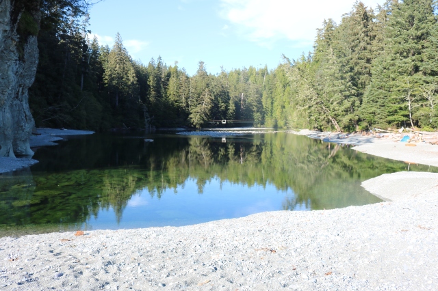
Everyone we’d chatted with (hiking north to south) had told us that today was going to be hard – between the mud and the roots and the ladders… We realized afterwards that because the trail gets easier as you travel north, this had been the hardest day for them, but little did they know what awaited them the next morning! So we really weren’t too concerned with the reports of a hard day ahead. We’d also heard that Walbran was the nicest campsite on the trail. It had a nice sandy beach, and a great swimming hole where the river pooled before seeping through the sand to the ocean.
We had a pretty lazy morning and didn’t leave camp till just before 10 am. The trail was pretty similar to the first day, but less elevation gain and drop and the mud was slowly drying up which was nice. Instead of being really slippery it was only slightly slippery and you didn’t loose an entire boot if you accidentally stepped in the wrong spot! We enjoyed looking for each kilometer marking and keeping track of our time from one to the next. We seemed to average about 20 minutes per kilometer except when there were huge sets of ladders going up and then back down shortly after. All that work to go down and back up a set of ladders and you’ve only covered 100 m of horizontal!

We arrived at Walbran early in the afternoon and after setting up the tent and hanging the fly to dry on some drift wood, we got into our bathing suits. With the sun out it was probably well over 25C, and I was determined to go swimming this time – not like last night where after 30 minutes of standing knee deep in the cold water weighing the pros and cons of swimming and watching nearly everyone else at the campsite start and finish their swim, I decided it was now too cold to swim. I waded in and by the time John was across the pool I had jumped in. It was so refreshing and with the hot sun it was actually really enjoyable and such a relief to be able to “shower” after two days of sweaty hiking.
Day 3: Walbran to Cribbs Creek via Chez Moniques and Carmanah Lighthouse – 11km
After two days of mostly walking in the forest, we were really looking forward to a beach walk. We were sure it would be way faster to able to walk along the beach for the majority of the day. Turns out, it actually wasn’t that much better. Often the sand was grainy and loose and we were constantly trying out different parts of the beach hoping to get firmer footing, but were mostly unsuccessful. Typically the closer you got to the water the better it was, until you got a boot-full of tide water (John)! So far we’d been lucky with hot sunny weather, and today was the same – beautiful and warm and dry – it might not have been much easier, but it was definitely a perfect day for it. So with our sights set on lunch at Chez Monique’s, we headed off!

After a yummy (and slightly pricey) lunch of burgers we headed up to the Carmanah Lighthouse to check it out. When we got there the lighthouse keeper had a telescope set up and was watching the sea lions sunbathing and barking on a rock just off the coast. They were so loud! And watching them sliding off the rocks and then back on was actually really neat to see – they’re so awkward and heavy that they have to wait for a wave to come and push them almost all the way onto the rock so all they have to do is shimmy up the rest with their flippers.

After meandering around the lighthouse for a while and daydreaming about living there (I’d bake cookies and make a killing selling them to hikers desperate for anything that didn’t come out of a tinfoil package), we signed the guestbook and were on our way. Only two more kilometers until we could set up camp for the night.
Again at Cribbs Creek, we found a nice but shallow swimming hole where the creek met the ocean. John swam in the ocean for the third day in a row before joining me in the creek for a “warm” swim/bath. Apparently after each dip in the ocean it made the creeks feel like a bathtub of sorts!
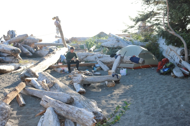
After our first meal of re-hydrated food served in a tinfoil bag, we joined the other hikers around a campfire. It turned out there were two other families from the Calgary area who’d started the day before us and were now on the same schedule as us when we caught up to them at Camper Creek. There were also two friends from Alaska hiking the trail from North to South who rolled in to camp just as we were finishing dinner and who, as it turns out, were just as interested in talking about hiking gear as John is!
The other groups were planning on a 7 am departure the next morning in hopes of making the beach walk during low tide. We weren’t too into the idea of getting up early enough to make the tide, but after a marshmallow each and a few bright meteor sightings, we went to bed when the rest of the campfire crew packed it in.
Day 4: Cribbs Creek to Klanawa River – 19 km, 8h
The next morning we headed off on the forest trail knowing we’d be cutting it too close on the tide timing. After 2 km in the forest we came to a beach access, and looking after assessing the situation thought that maybe we’d actually be fine since it seemed like an easy and fast walk on the rock and the tide didn’t seem to be an issue at the moment. We didn’t realize until we got down there and half way around Dare Point, that the “beach” was actually a rock plateau and as soon as the tide was high enough the whole thing would flood. It was already at 2 inches which was enough to make it annoying to walk through and it looked like every wave was bringing in more water. Not to mention the surge channel that we had to jump over as the water was crashing in. We were pretty stressed out with the rising water and crashing waves and after quickly cramming the camera into a backpack we all jumped over the surge channel one by one trying to time it with the less aggressive waves. Definitely not the safest moment on the hike, but as we were scrambling to avoid the rising tide, we noticed a rickety old set of ladders leading straight up the cliff ahead. We hurried up them relieved to have found a way back in the forest and away from the tide.
We got into Nitinat Narrows at 12:30 after 3.5 hours of hiking ready for a hot seafood lunch. One of the groups the day before had lent us $60 cash so we could buy lunch at the Narrows. We hadn’t been aware that there were multiple lunch spots and after losing a third of our cash to parking at the start of the trip we didn’t have enough to cover more than the one lunch at Chez Moniques. (In case you were wondering, these are by far the most expensive lunch dates we’ve ever gone on, and two in one week, on a hiking trail no less!) As soon as we got in we ordered a BBQ salmon ($25), a crab ($30) and a ginger ale ($2). As John was watching our crab being prepped, I munched on a nasturtium flower – a gift from Hippie Doug our soon to be ferry captain across the narrows after lunch. Gentlemen – in case you’re looking forward to enjoying an appetizer of nasturtiums in the middle of your hike, you should be warned, that Hippie Doug (this is what his name tag says, I swear!) reserves his flowers and candies for lady hikers only. No questions, no explanations. (Our theory is that he attempts to woo every female hiker passing through with one flower and one candy, in hopes that one of them will be so smitten, or so sick of tromping through the mud, that she will stay and live happily ever after with him at Nitinat Narrows!)
Lunch was delicious and worth every penny. The BBQ’d salmon comes with a baked potato, a heap of margarine and lots of salt and pepper. The crab is served plain – literally just a crab on a plate and you’re absolutely not allowed to contaminate the crab or the plate on which it comes with margarine. Hippie Doug patrols the picnic tables making sure that these rules are followed. But after one bite of crab, you understand why you’re not allowed any margarine. The crab is absolutely delicious on it’s own.


The going after the Narrows wasn’t too bad. There was a nice mix of forest and beach walking and it stayed sunny until we got to the Hole in the Wall about a kilometer from Tsusiat Falls when the fog rolled in.


When we got to Tsusiat we put our packs down and wandered over to look at the falls. We’d been set on staying there that night since I’d remembered it as the nicest camp spot and a fun place to shower in the falls. But there were so many campers already set up there, and the falls actually didn’t look quite as nice as I’d remembered not to mention there was a flock of seagulls floating in the pond where we’d need to get our water from – that or wade waist deep into the water to get to the falls neither of which seemed appealing, so we put our packs back on and headed over to the ladders leading up to the trail. It was only another 2 kilometers to the next campground and we’d heard it had a nice river so we thought we’d give it a shot.
Klanawa River turned out to be one of the better campsites on the hike. And because Tsusiat is so hyped up and it’s already a long day to get there if you’re coming from the south, Klanawa was empty when we arrived. Over the course of the evening only 2 other couples camped at Klanawa and we were all nicely spread out among the driftwood. For the first night of the hike, it actually felt as though we were on a back-country hike in the wilderness! After a swim in river we made a little campfire and settled down for an early night.
Day 5: Klanawa River to Michigan Creek and a bear sighting – 11 km
Today was a short day distance wise. We had a lazy morning and didn’t get going until mid-morning after the first group of hikers had already walked by heading north. It was the first day we hadn’t woken up to a bright and sunny weather and instead the thick fog kept rolling in from the ocean continuously. After a short photo shoot on the giant driftwood trees by our campsite we headed north up the beach. As usual we met hikers heading south – usually we stopped to chat about where they were hiking from and what their trail plans were and any ensuing conversation. So far along the hike we’d met people from Germany, Bulgaria, the Netherlands and the US, along with almost every province in Canada, but this morning the couple we met had a more familiar accent. It turns out they were from Brno (Czech Republic) so John got to practice his Czech for a few minutes!

When planning our campsites we’d heard a lot of good things about Darling River – that it was nicer and larger than Michigan, but the drawback when you’re heading north is that it’s an extra 2km on the hike out which can matter for some groups catching the shuttle – so we hadn’t been able to make up our mind about where to stay for the last night. We decided to decide when we got there. I have to say, Darling River was one of the coolest looking campsites of the trip. If we had to describe the campsites with vacation themes it would probably go something like this:
Camper Creek – Tofino Beach Front Resort (this was by far the busiest camp site we were at with colourful tents covering the beach)
Walbran – Cottage on the Lake (the beautiful swimming hole with the raft and buoy rope swing…)
Cribbs Creek – African Safari (those sea lions never stopped barking all night long!)
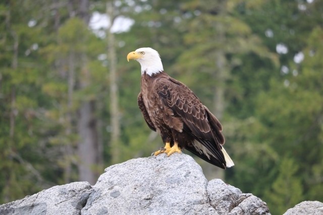
Klanawa – Peaceful Treehouse Forest Retreat (we saw a bald eagle flying back to its nest with a fish in dangling from it talons as we were making dinner)
Darling River – Bustling Metropolis (There is something for everyone here! From the TV permanently tuned in to WCT channel and the custom made lounge chairs, to a state of the art tether ball court, rope swing and hammocks a-plenty.)
Darling River was so fun to explore! After John caught a few episodes of WCT TV (someone cleverly set up a washed up window frame in front of the ocean so the “TV” is permanently “tuned in” to the ocean) in the driftwood lounge chair we headed to the north end of the campsite for a tether ball match. The tether ball was quite a bit larger than normal and the driftwood pole that it was set up on was definitely curved in John’s favour (my excuse for loosing round after round!), but it was still a fun break in the middle of a hike! The sun finally came out during our tether ball game so afterwards we took a break and enjoyed the sun and some conversation with a hiker setting up camp for the night. Mid conversation, we heard a rustle in the salal bushes and we all watched as a mid-sized black bear ambled out of the bushes. He wasn’t too far away so I jumped up to grab my camera and see if I could get a picture but as soon as he saw us he turned around and headed back into the bushes. We decided that we would also be on our way. He had seemed pretty harmless but it just seemed like a good idea to camp elsewhere if possible. Surprisingly there had only been one person planning on setting up camp at Darling, and after the bear sighting we all decided to head our respective ways to the next camp site en route.

The fog rolled back in as we arrived at Michigan Creek and with the wind picking up it was a chilly evening. Definitely no swimming tonight, but that was okay since tomorrow we would be on our way out and back into civilization for the night.
Day 6: Michigan Creek to Pachena Bay – a rolled ankle and a lonnnng bus ride – 12 km, 2.5h
This was by far the fastest and easiest day on the trail. It was a combination of the well groomed trail and boardwalks and the very light packs (37 lb each at the end – John was convinced his was heavier the whole hike, but they were both the same at the end and I was carrying most of the food. Hmmm…). We had planned on leaving around 8:30 in the morning to make sure we arrived in time for the shuttle. The shuttle was scheduled to pick up hikers heading to Gordon River/Port Renfrew at 1:45pm, but we had heard rumors that the shuttle driver might be willing to bring hikers into Bamfield with him for lunch if you were there at noon when he was dropping people off at the Pachena Bay trail head. This was our goal. We had $10 left and wanted to spend every last penny of it in Bamfield if possible. Our plan was to leave at 8:30 from Michigan and arrive by 11:30am. We figured if we’d been able to average 3 km/h for the majority of the trail (or 1 km every 20 minutes) we should be able to manage a bit more on the last and easiest day. We were the last group to leave that morning as it seemed no one wanted to take any chances with the shuttle and the campsite was empty by 8 with most groups having left even earlier. It turns out we were able to make great time! In fact we were on a roll and having fun speed walking and running and seeing how fast we could make it to the next kilometer marking. I don’t remember the times now, but we were setting (WCT hiking) PB’s left, right and center today! Until John took it a bit too far… With just over 2 km left in the hike, John decided it would be funny to goof around with some branches while speed walking down a hill. Almost instantly he rolled his right ankle. And then we went from setting PB’s to painstakingly slow shuffling for the next few hundred metres, and then a (very) slow walk for the last 2 km. Thank goodness we were almost done and way ahead of schedule for the shuttle! And after a last few ladders (we weren’t expecting those at all! But I guess those North to Souther’s need something to get ready for the south end!) we were done. Six days, five nights and 75 km of hiking – what an adventure!
Ps. The shuttle never did come at 12 so we resigned ourselves to crackers, cheese and the last of the avocado which had actually held out very well for the whole trip.